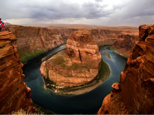
river surrounded by red rock desert
Enabling holistic thinking about the stewardship of our water

Arizona Water Blueprint

About the Project

Tools for exploring Arizona's water resources


icon showing abstract charts and graphs


The Water Blueprint Map

A comprehensive tool featuring 50+ data layers to explore Arizona’s water resources and infrastructure

icon showing signposts


Colorado River Shortage

An information hub about the Colorado River shortage

icon of water droplet


Groundwater Level Changes

An interactive map that shows groundwater level changes across Arizona’s sub-basins

icon showing abstract map


Water Issues in Depth

Introductions to critical Arizona water issues like the use of water in rural areas and the function of watersheds

Sign up for updates

Want to keep learning about water in Arizona? Sign up to receive emails from the Kyl Center for Water Policy at Morrison Institute.

Sign me up

Why the Water Blueprint?


Data visualization that's both powerful and easy-to-use

Shaped by 200+ water officials, community members, and educators

We saw people struggling to find answers to their questions about water. Water source information was so hard to find that one community official had resorted to carrying it around with her on a hand-drawn map.

We created the Water Blueprint to make information about water resources and infrastructure accessible to civic leaders, home-buyers, professionals, and anyone else who needs it. It empowers community members to learn about Arizona's water with over 50 data resources in one easy-to-use place — no GIS experience needed.

Learn how to use it

View the comprehensive map

screen shot of arizona water blueprint map
Two hands surrounding a small branch with leaves

60+ data layers

Bringing together data from local, state and federal agencies to build the most comprehensive tool on Arizona’s water

Available Data

Water droplet within arrows representing updates

Frequent Updates

We are always adding new data and updating existing data streams as they are available

About Our Data

Outstretched hand catching water droplets

Guided by Experts

Over 200 water officials, community members, and educators helped us shape the tool

About the Project

Praise for the Arizona Water Blueprint


The Blueprint provides “overlays of cities, member lands/service areas, assured water supply designations, wells, recharge facilities, and water use—all in one portal.

Lauren Hixon, Town of Gilbert

It's the best comprehensive tool and use of data/data showcase to be available since the Water Atlas.

Karen Modesto, Arizona Department of Water Resources