closeup of a dry, cracked field with a dry pipe running out of the ground

Story Map

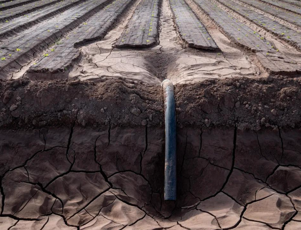
Groundwater Depletion in the Colorado River Basin

The Colorado River Basin is experiencing diminished flows in its rivers and streams. This story map explains how satellite data can measure changes in total water storage, a new and efficient means of measuring groundwater changes.

Topics in this resouce: Groundwater, Colorado River Drought and Shortage, Agriculture
View the Groundwater Depletion Story Map
ASU water blueprint logo

A project of the Kyl Center for Water Policy at Arizona State University's Morrison Institute for Public Policy

Sponsors of the Arizona Water Blueprint

ASU Kyl Center logo
Maps and Locations Jobs Directory Contact ASU My ASU
Repeatedly ranked #1 on 30+ lists in the last 3 years
Copyright and Trademark Accessibility Privacy Terms of Use Emergency